There is a place on the road between Đồng Văn and Mèo Vạc where almost everyone stops talking.
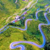
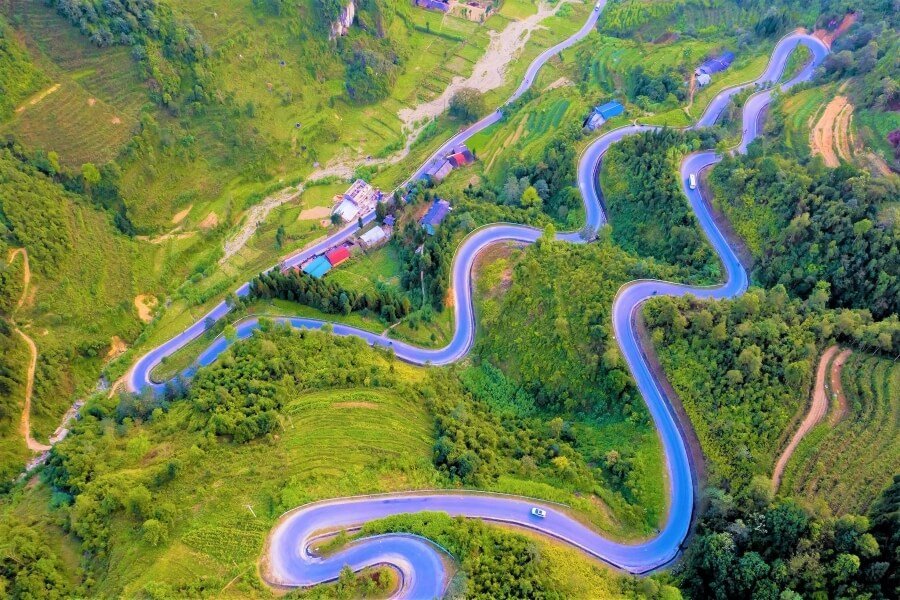
You come around a shoulder of rock and the mountain simply falls away. Far below, several hundred metres down a near-vertical gorge, the Nho Quế River runs a startling jade green, so narrow from up here it looks like something spilled. The road you are standing on is a ledge cut into the cliff face, barely wider than two vehicles.
This is Mã Pí Lèng, and the reason it deserves more than a photo stop is that none of it should exist.
What the name means
Mã Pí Lèng comes from Hmong, and the usual translation is “the horse’s nose bridge”, the point where the climb is so steep a horse must stop and catch its breath. Local people will tell you it more bluntly: the slope where the horse gives up.
For most of history, that was the honest description. There was no road. The villages on the Đồng Văn karst plateau were among the most isolated in Vietnam, reachable only on foot along mountain tracks. Salt, medicine and cloth came in on the backs of people and horses. In a bad year, that isolation was measured in lives.
The Happiness Road
In 1959 the government began building a road across the plateau. It was named Đường Hạnh Phúc, the Happiness Road, and it runs roughly 200 kilometres from Hà Giang city through Quản Bạ and Yên Minh to Đồng Văn and Mèo Vạc.
It took about six years, finishing in 1965. It was built almost entirely by hand.
Thousands of workers came from across the northern provinces, alongside labourers from many of the local ethnic groups, Hmong, Tày, Dao, Lô Lô, Pu Péo and others. They worked with hammers, chisels, crowbars and baskets. Rock was broken by hand and carried away by hand.
The Mã Pí Lèng section was the worst of it. Roughly twenty kilometres of sheer limestone, and no ground to stand on while you worked. The solution was brutal in its simplicity: men were lowered on ropes down the cliff face and hung there, chiselling footholds into the rock so that a ledge could slowly be widened into a road. The crews who did that work are remembered locally as the volunteer squads who went over the edge, and a number of them died on the mountain.
That stretch alone took the better part of a year.
When you stand at the viewpoint now, look at the cliff above and below the road. The scale of what was cut away is visible, if you know to look for it. It was recognised as a national heritage site in 2009, and the surrounding Đồng Văn Karst Plateau became Vietnam’s first UNESCO Global Geopark in 2010.

What you actually see from up there
The Nho Quế gorge. One of the deepest and narrowest in Southeast Asia. From the pass the river is a thin green line hundreds of metres below.
Tu Sản canyon. The dramatic slot section of the gorge, best seen from the water. Small boats run from Tràng Hương pier, and the walls rise vertically on both sides. Riding the pass and taking the boat are two completely different experiences of the same place.
The Sky Path. A narrow walking trail contouring along the cliff below the main road. It is exposed, and worth it if you have a head for heights.
Riding it
- Go slowly. Not for the danger, for the fact that you will want to stop constantly, and rushing this stretch is a genuine waste of a trip.
- Watch the cloud. The plateau makes its own weather. A clear morning can close in by noon, and in thick fog the view is simply gone. Mornings are usually the best bet.
- Stop where stopping is safe. There are proper pull-offs and viewpoints. Parking on a blind corner for a photo is how accidents happen here, and it happens more than it should.
- Best months. September and October for clear air and the rice harvest. Spring is beautiful too, with flowers on the plateau, though the mist is more persistent.
Why we tell the story before the ride
Plenty of tours take you across Mã Pí Lèng, hand you a viewpoint and move on. It photographs well, and that is usually the end of it.
We would rather you knew what you were looking at. A road that took six years, cut by people hanging off a cliff on ropes so that villages three days’ walk from anywhere could finally reach the rest of the country, that is a different thing to look at than a nice view.

Stand there for a while. It is worth the twenty extra minutes.